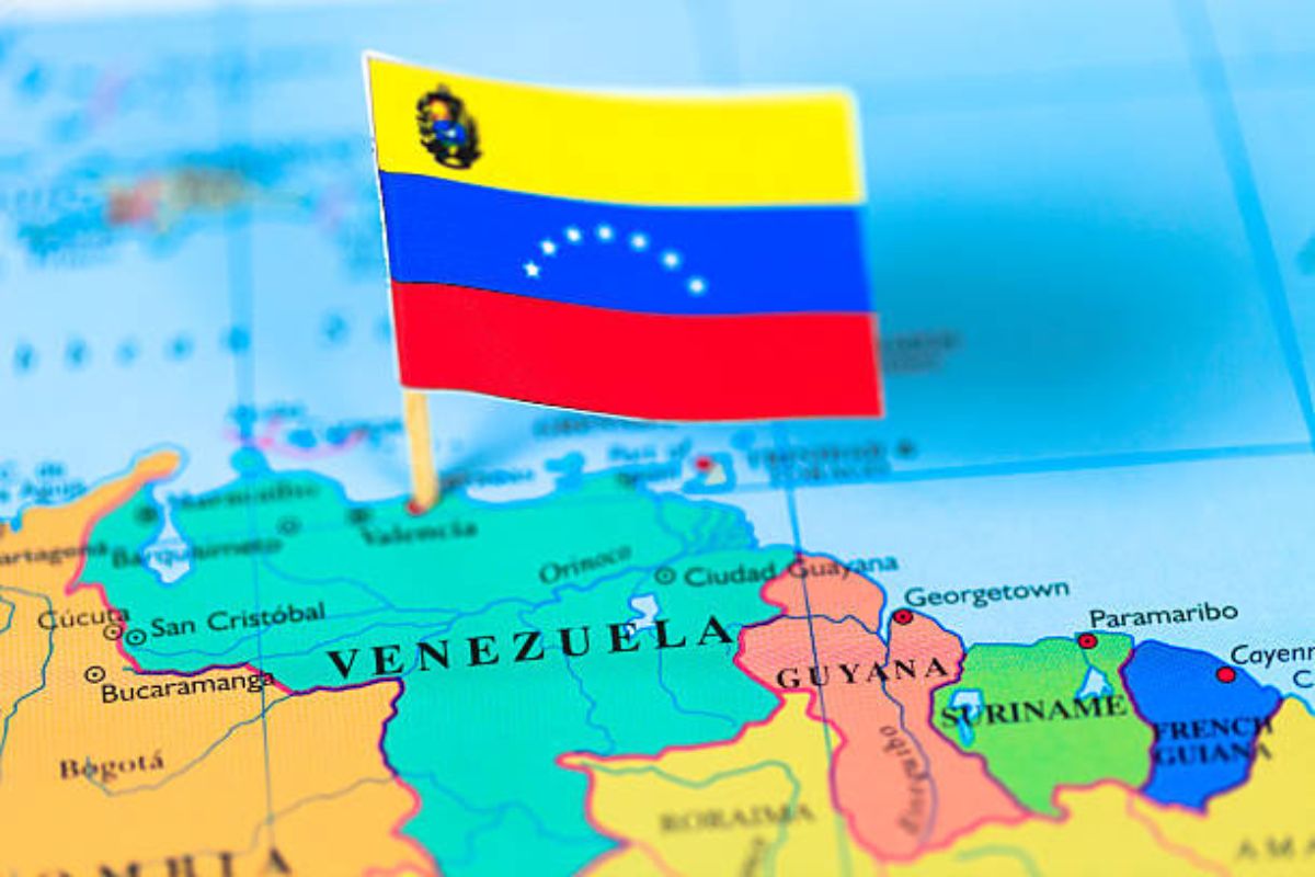
Venezuela is situated on the northern coast of South America, at the very top edge of the continent. It lies in the Northern and Western Hemispheres, facing the Caribbean Sea to the north and the North Atlantic Ocean to the northeast. Venezuela shares land borders with Colombia to the west and southwest, Brazil to the south, and Guyana to the east. Its location makes it a bridge between the Caribbean region and the South American mainland, and it sits along major sea and air routes linking North and South America.
Borders and Coastline
Venezuela’s northern coastline stretches for about 2,800 km along the Caribbean Sea. Off its northern shore lie many Caribbean islands and it shares maritime boundaries with several Caribbean nations (including Trinidad and Tobago, Barbados, and others). The country’s triangular shape opens to the north, giving Venezuela a long Caribbean coast with warm tropical waters. Inland from the coast, Venezuela’s terrain rises quickly into mountains and highlands (described below). To the west, the border runs along the eastern flanks of the Andes into Colombia; to the south it follows rivers and jungle boundaries with Brazil; and to the east it meets the Rupununi savannas and highlands of Guyana.
Major Geographic Features
Venezuela’s landscape is geographically diverse. In the northwest, the Andes Mountains extend into Venezuelan territory (the Cordillera de Mérida), reaching elevations above 4,500 m. The country’s highest peak is Pico Bolívar (4,978 m), in the Sierra Nevada of Mérida state. Those northern Andes also border the Maracaibo Basin, a lowland area around Lake Maracaibo (Venezuela’s largest lake).
The Orinoco River dominates central Venezuela. It drains a vast plain known locally as Los Llanos, flowing eastward across the country. The Orinoco is one of South America’s longest rivers (over 2,000 km) and it empties into the Atlantic via a large delta in eastern Venezuela. About 95% of Venezuelans live north of the Orinoco, highlighting its role as a cultural and geographical dividing line.
In the southeast, the ancient Guiana Highlands (or Guayana region) rise up from the Amazon basin. This region features tropical jungles and dramatic “tepui” table-top mountains. It is home to Angel Falls – the world’s highest waterfall – and peaks reaching ~3,000–3,500 m. These highlands form part of the Guiana Shield, a stable geological block extending into Guyana and Brazil. Altogether, Venezuela includes coastal mountain ranges, inland plains (llanos), Andean peaks, and the lush Guiana Plateau, making it one of South America’s most geographically varied countries.
Major Cities
Venezuela’s largest cities are mostly concentrated along the northern coastal and Andean regions. The capital city, Caracas, lies in the coastal mountains north of the central plains, and is the country’s cultural and administrative center. Other major cities include:
-
Caracas – Capital and largest city (metro ~3 million people), located in northern Venezuela near the Caribbean coast.
-
Maracaibo – Second-largest city (~2.3 million), on the western edge of Venezuela by Lake Maracaibo in Zulia state. It is a major oil-producing region.
-
Valencia – Third-largest city (~2.0 million), in north-central Venezuela (Carabobo state), located in a fertile valley southwest of Caracas.
-
Other important cities include Barquisimeto (west of Caracas), Maracay (north of Valencia), and Ciudad Guayana (on the Orinoco in the southeast).
These cities serve as economic hubs and are connected by highways and oil pipelines. Most of Venezuela’s population and industry lie in these northern and western areas, reflecting the mountainous and coastal geography.
Regional and Geopolitical Significance
Venezuela’s location and natural resources give it notable regional influence. It sits at the crossroads of the Caribbean and South America, historically linking the Spanish-American world with the Caribbean. Economically, Venezuela has been a major oil exporter: it was a founding member of OPEC and sits atop some of the world’s largest petroleum and natural gas reserves. Its Orinoco Belt of heavy oil has made it strategic for global energy markets. Through programs like Petrocaribe (launched 2005), Venezuela used oil as a diplomatic tool, supplying fuel on favorable terms to Caribbean neighbors as part of a broader “petro-diplomacy” initiative.
Politically, Venezuela (officially the Bolivarian Republic of Venezuela) has been a prominent member of Latin American organizations. It is part of alliances such as the Bolivarian Alliance (ALBA) and was influential in creating regional blocs (like the Union of South American Nations). Its coastline also made it a historic naval outpost during colonial times and provides access to major Atlantic shipping lanes.